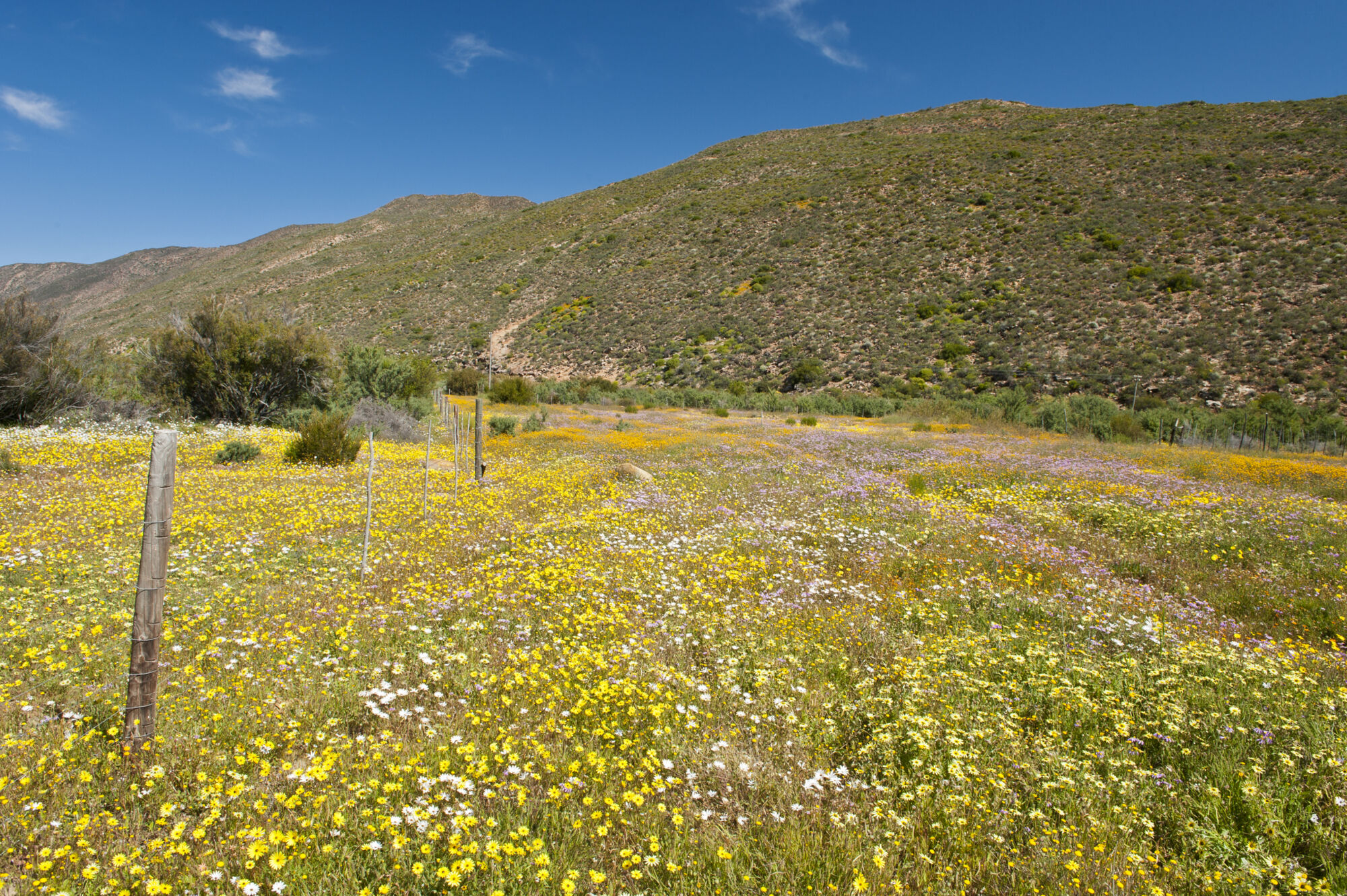
My plan was to escape the city for a few days of wilderness exploring and travel the entire length of the Cederberg, one of the most beautiful and beguiling mountain ranges in Africa. It was early spring; the veld was green and flecked with the dancing heads of countless daisies as I drove north. I stopped to open a farm gate and the golden light, smell of dust and lure of flat-topped koppies stretching to the horizon was intoxicating.
The Cederberg’s northern ‘border’ is the Doring River and my first stop, after a three-hour drive from Cape Town, was Oudrif Cottages on the Doring’s southern bank. Oudrif is an eco-lodge with a mission to prove that sustainability works. There’s solar power, the windows and doors were salvaged from old buildings, water comes from the nearby stream, vegetables grow on site and the cottages are built from straw bales (a natural insulator) plastered with cement. Owner Bill Mitchell – river guide, chef, landscaper, conservationist – explained how he’d tried to occupy a minimal footprint, hardly clearing any vegetation and using only exotic wood and recycled materials.
Bill’s wife, Jeanine, showed me round, then suggested a walk on the northern bank of the Doring. We paddled across the stream, skirting rapids that roared over rocks polished like metal, then climbed a koppie through veld purpled with beesvygie flowers and dotted with botterboom trees. From a cliff, we looked down on the river and watched a Cape clawless otter swimming upstream, no doubt hunting for yellowfish.

We leapt across a tributary that boiled through a series of cauldrons and came to a cluster of rock-art sites. Some of the works were remarkably clear, as though the stalking stick figures and their rhebok prey had been painted only yesterday.
My next overnight stop was luxurious Bushmans Kloof Retreat, a complex of thatched buildings enclosed by a white wall snug in a valley. I joined a group of guests on a visit to a local rock-art site. We descended a path worn by centuries of feet to an overhang painted with elephants and eland, caracals and aardvarks. Our ranger explained how only the more potent ochre and yellow colours remained; the blacks (derived from charcoal or manganese dioxides) and whites (from clay) had faded over time. He told us that this site could have been an initiation spot. There was an image of a hunt (two boys trying to bring down an elephant cow), fertility symbols and a fissure that led to the spirit world. The rock was a thin veil between this reality and another.
The road to the Moravian mission station of Wupperthal led south through the Biedouw Valley, resplendent with spring flowers. I passed Cape Dutch homesteads surrounded by orchards, then wound down Kouberg Pass to the picturesque mission on the banks of the Tra-tra River. Founded in 1830, many Khoisan fleeing persecution took refuge here, settled and were converted to Christianity. There’s an elegant church, pastorie and rows of houses terraced into a south-facing hill above the river. The architecture is typical Cape – whitewashed and thatched cottages, many with vine pergolas and stoeps.
From Wupperthal there are walks, drives and 4x4 tracks that take you to outlying settlements such as Beukeskraal, Prins-se-Kraal and Heuningvlei – a village at the foot of Krakadouw’s peaks, which offer some of the toughest hiking in the berg. In these hamlets, you come face to face with a Cederberg that preserves the old way of life. The architecture is simple and utilitarian, the farming is at subsistence level and a donkey cart is often still the primary means of transport. The folk remain in touch with their Khoisan past, displaying a rich knowledge of the berg, its fauna and flora; recipes and aspects of the language still hark back to a time before the ancestors came down from the mountain and found sanctuary among the missionaries.

If you have a 4x4, there’s a rough road that runs south of Wupperthal down the spine of the central berg. It leads through spectacular terrain of convoluted rock formations, montane fynbos and tea-coloured streams. The backdrop to the drive is provided by two towering peaks: Sneeukop and Tafelberg. I spent a few delightful hours following this road until I came to Sanddrif, where I based myself for a few days of southern-berg exploration. The resort comprises comfortable cottages and camping sites strung along the Matjies River.
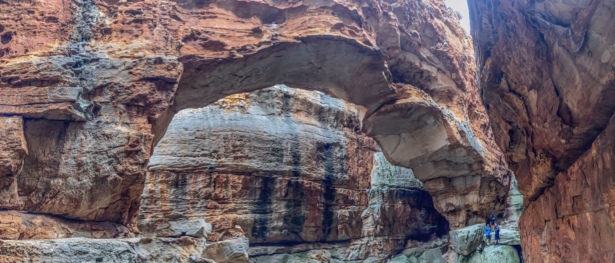
From Sanddrif, your exploits should be on foot. For many visitors, the Cederberg is all about hiking. These are particularly accommodating, gentle mountains, with countless paths for rambling. The landscape fits like an old shoe. You can wander for days among its heights, through castles of sandstone stained with iron oxide. Everywhere there is water: cutting through kloofs, tinkling off ledges or springing from barren ground. The closest – and arguably the most striking – trail from Sanddrif is to Wolfberg Cracks, a series of rock arches set within enormous fissures above Red Gods Valley. Also relatively nearby is the spectacular Maltese Cross. Both routes make for superb hiking.

From Sanddrif, you can exit the berg to the northwest via Uitkyk Pass and Algeria, or continue south through the mountains, finally emerging at the Boland town of Op-die-Berg. I opted for the latter. The road runs through rugged terrain, the land is drier and there are fewer signs of habitation.
On Blinkberg Pass I got out and knelt by a spring, cupping water that tasted of stone and vegetable matter. Then I looked back. The Cederberg stretched north in a line of peaks like the spine of a kogelmander (agama). The rock was blood red in the setting sun, almost liquefied by the light. I stood for a long time, utterly transfixed by the sublime vista, then climbed back in the car and took the long road south…
VISIT IT:
The Cederberg is a year-round destination, with plentiful and varied accommodation available.
☀️: If you’re hiking or climbing, it can get terribly hot in mid-summer.
❄️: During winter, there’s often snow on high ground, so come prepared.
🌸: Spring is flower time and very popular.
Peter Slingsby’s excellent Cederberg maps are great for touring and hiking, or get hold of a 1:50 000 topographic map from CapeNature.


